
Looking for expert GPS site survey services in Wisconsin? Trust JK Trenching for accurate, reliable surveys backed by 25+ years of experience. Contact us today!
When it comes to precise land management and accurate data collection, GPS site surveying has revolutionized the way professionals assess and plan construction, agriculture, and development projects. If you’re looking for expert GPS site survey services in Wisconsin, JK Trenching offers specialized services that combine decades of experience with cutting-edge technology to provide superior results. Their expert team uses advanced GPS equipment to deliver detailed and reliable site surveys, helping businesses, farms, and construction companies in Wisconsin make informed decisions based on accurate data.
In this article, we will explore why JK Trenching is a leading provider of GPS site survey services in Wisconsin, the various applications of GPS site surveys, and how their services can benefit you. If you’re seeking a trusted partner to handle your site survey needs, JK Trenching is the name you can count on.
What Is GPS Site Surveying?
GPS site surveying is the use of Global Positioning System (GPS) technology to collect accurate data on the position, elevation, and other physical features of a land parcel. The technology allows surveyors to map out land contours, determine the best use of the space, and identify any potential challenges such as drainage problems, elevation changes, or uneven terrain. This is crucial for industries like agriculture, construction, and land development where precision and data-driven decisions are required.
GPS surveys are highly beneficial because they offer:
- Accuracy: GPS technology provides precise coordinates, ensuring that all measurements are accurate, eliminating the guesswork involved in traditional surveying methods.
- Efficiency: GPS site surveys are faster, requiring fewer manual measurements compared to conventional methods.
- Real-Time Data: The data is available in real-time, allowing for quicker decision-making and more efficient planning.
- Versatility: GPS surveying can be used in various applications, from land development to agricultural drainage systems.
Why Choose JK Trenching for GPS Site Surveys?
When choosing a GPS site survey service provider in Wisconsin, it’s essential to look for a company with the right expertise, experience, and tools. JK Trenching has been a family-owned business since 1996, and their vast experience in land management, combined with their commitment to utilizing state-of-the-art technology, makes them a leading choice for clients across Wisconsin. Below are the key reasons why JK Trenching is the go-to provider for expert GPS site survey services:
1. Extensive Experience in Land Management
JK Trenching is not just a GPS site survey provider; they have over 25 years of experience in land management, particularly in the agricultural sector. Founded by brothers Keith and Jeff Newhouse, the company has built a reputation for delivering high-quality services to Wisconsin’s farmers, land developers, and construction professionals. Their wealth of experience means they are well-versed in the unique needs and challenges that come with various types of land, from agricultural fields to urban construction sites.
2. State-of-the-Art GPS Technology
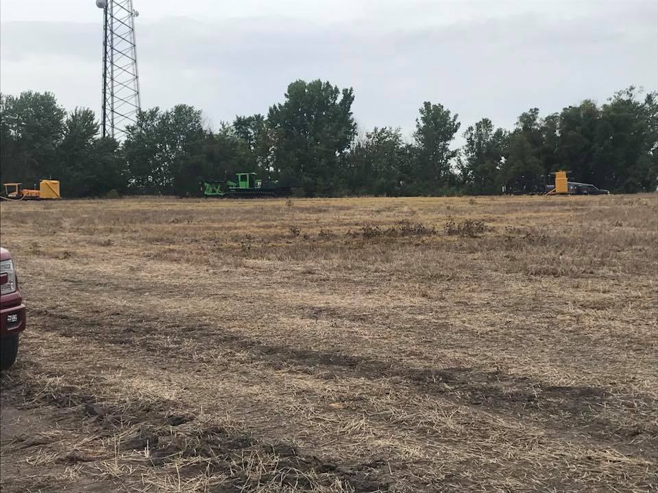
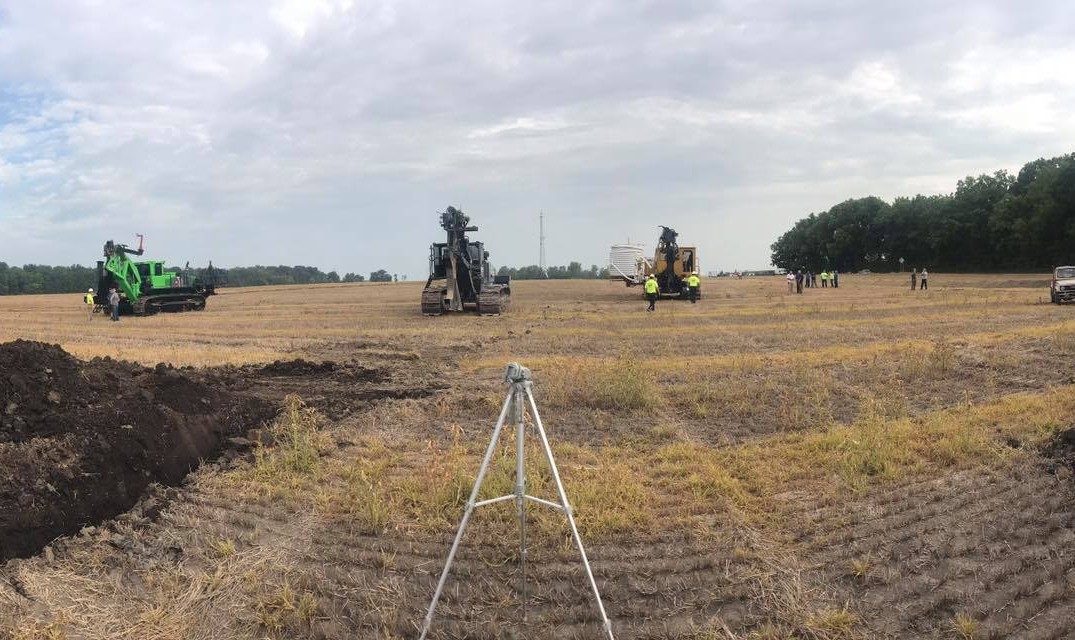
To ensure the most accurate and detailed site surveys, JK Trenching employs the latest GPS technology. Their team uses advanced GPS equipment that offers high precision and fast data collection. With this technology, they can provide accurate topographical maps, elevation data, and site measurements that are vital for planning construction projects, drainage systems, and land development.
By incorporating cutting-edge tools like GPS-guided trenching equipment, JK Trenching is able to offer an integrated approach to land management. This means they can not only conduct the surveys but also use the collected data to implement effective solutions for their clients.
3. Specialized Knowledge in Agricultural Drainage
A significant portion of JK Trenching’s services is focused on agricultural drainage. Accurate GPS site surveys are crucial for identifying areas where water tends to accumulate and where drainage systems need to be installed. By analyzing the land’s topography and soil conditions, JK Trenching can help farmers prevent waterlogging, improve crop yields, and ensure the health of their land.
In addition to GPS surveys, JK Trenching also provides drain tile installation services, which involves using GPS data to position drainage systems in the most effective locations. This prevents damage to crops, soil erosion, and flooding.
4. Comprehensive Services for Land Development
In addition to GPS site surveying, JK Trenching offers a wide range of land development services, including ditch cleaning, snow plowing, and erosion control. This comprehensive service suite ensures that once the survey is complete, the team can also assist in implementing the necessary improvements based on the data collected. This makes JK Trenching a one-stop shop for all land management needs.
5. Client-Focused Approach
As a family-owned business, JK Trenching places a strong emphasis on building lasting relationships with their clients. The company’s commitment to personalized service means that they take the time to understand the unique needs of each client and tailor their services accordingly. Whether you are a farmer looking to improve drainage on your property or a construction company needing detailed site maps, JK Trenching ensures that your project is handled with the utmost care and precision.
Applications of GPS Site Surveys
GPS site surveys have a wide range of applications across various industries. Here are some of the most common ways GPS surveys are used:
Agricultural Drainage
One of the most important applications of GPS site surveys is in agricultural drainage. Farmers rely on accurate survey data to ensure that their fields are properly graded and drained. GPS surveys can help identify areas of the land that are prone to waterlogging, allowing farmers to install drainage systems that improve soil health and crop productivity. JK Trenching uses this technology to design and install efficient drainage systems that ensure water is channeled away from crops and into designated areas, preventing damage to the land.
Land Development
For construction projects, GPS site surveys are invaluable. GPS technology enables construction professionals to map out the land’s topography with incredible precision, ensuring that the project is planned in accordance with the land’s natural contours. This helps in the efficient placement of infrastructure, such as roads, buildings, utilities, and landscaping. GPS surveys can also identify any potential challenges, such as uneven terrain or areas prone to flooding, that may impact construction.
Environmental Planning
In environmental planning, GPS site surveys are essential for identifying important land features, such as wetlands, floodplains, and areas with protected wildlife. This data is crucial for compliance with environmental regulations, ensuring that development projects do not harm the local ecosystem. GPS surveys also help in assessing the impact of land development on the environment, enabling developers to make more sustainable choices.
Mapping and Infrastructure Planning
GPS surveys are also used for creating maps of existing infrastructure, such as roads, utilities, and drainage systems. By having accurate, up-to-date data, municipalities and developers can plan for maintenance, upgrades, or new construction projects. The ability to integrate GPS data into Geographic Information Systems (GIS) allows for better visualization of the land and infrastructure, aiding in long-term planning.
Service Areas in Wisconsin
JK Trenching provides GPS site survey services to clients across the state of Wisconsin, from rural farmlands to urban development projects. Their extensive service area ensures that businesses, farmers, and landowners throughout the state have access to their high-quality surveying and land management services.
Whether you’re located in central Wisconsin, near the Wisconsin Dells, or closer to Milwaukee or Madison, JK Trenching is ready to assist with your site survey and land development needs. Their team travels across the state, providing accurate and reliable services regardless of location.
How to Get Started with GPS Site Surveys from JK Trenching
Getting started with JK Trenching for your GPS site survey needs is simple. Follow these steps to begin:
1. Contact JK Trenching
Visit the JK Trenching website or call their team to schedule an initial consultation. Their team will discuss your needs, whether it’s for agricultural drainage, construction planning, or environmental surveying.
2. Site Evaluation
The team at JK Trenching will visit your site to conduct a thorough evaluation. They will assess the land, discuss your goals, and determine the best approach for gathering accurate data through GPS site surveys.
3. Survey Data Collection
Using their advanced GPS equipment, the JK Trenching team will begin collecting data from the site. The process is quick, accurate, and non-invasive, ensuring minimal disruption to the land.
4. Review and Implementation
Once the data is collected, JK Trenching will provide you with a comprehensive report. If needed, they will also assist in implementing the required drainage systems or land improvements based on the survey data.
5. Ongoing Support
JK Trenching offers ongoing support to ensure your project runs smoothly. Whether you need additional surveys or assistance with land improvements, their team is ready to help.
Conclusion
For expert GPS site survey services in Wisconsin, JK Trenching is a trusted name that combines years of experience with the latest technology to deliver high-quality results. Whether you are a farmer looking to improve drainage on your property or a developer planning a construction project, their team is dedicated to providing precise and reliable survey data that will help you make informed decisions.
With a client-focused approach, cutting-edge GPS technology, and a comprehensive suite of land management services, JK Trenching ensures that your project is in capable hands. Contact them today to get started on your next project and experience the difference that expert GPS site survey services can make.
Call to Action:
Get in Touch Today: Need an expert GPS site survey in Wisconsin? Contact JK Trenching for accurate results and exceptional service. Visit jktrenching.com to request a consultation now!
FAQs: Expert GPS Site Survey Services in Wisconsin
What are GPS site surveys used for?
GPS site surveys are used to collect accurate data about the land’s position, elevation, and contours. They help in agricultural drainage, construction planning, environmental planning, and mapping infrastructure.
How accurate are GPS site surveys?
GPS site surveys are highly accurate, providing precise coordinates and measurements. This allows for better planning and decision-making in land management projects.
How does JK Trenching ensure the accuracy of its GPS site surveys?
JK Trenching uses advanced GPS equipment and technology to collect real-time data with high precision. Their experienced team ensures the highest level of accuracy for every project.
Can JK Trenching help with both agricultural and construction projects?
Yes, JK Trenching specializes in both agricultural drainage and construction site surveys. They tailor their GPS surveying services to meet the unique needs of each project.
Where does JK Trenching offer its services?
JK Trenching offers GPS site survey services throughout Wisconsin, ensuring accurate surveys for farms, construction projects, and land developments across the state.